Unusual Geography Facts: India's Collision, Time Zones & More
Unusual geography facts reveal a world full of surprises, from India's tectonic collision with Asia that raised the Himalayas to France's claim of 12 time zones, and these strange truths reshape how we see the planet. These oddities pull you in because they challenge the mental maps we all carry, making familiar places feel suddenly foreign and fascinating.
This article explores a collection of unusual geography facts, including India's ongoing collision with Asia, France's 12 time zones due to overseas territories, Australia's unique marsupial population, and several other surprising truths about our world's physical and political landscape.
- India began colliding with the Asian plate roughly 50 million years ago, a process that created the Himalayan mountain range and continues today.
- France holds the record for the most time zones of any country, with 12 spanning its mainland and overseas territories.
- Australia is home to the majority of the world's marsupial species, including kangaroos, koalas, and wombats.
- Brazil is the only country in South America where Portuguese is the official language, a legacy of colonial history.
- Lesotho, San Marino, and Vatican City are among the world's few true enclaves, countries entirely surrounded by another single nation.
Unusual Geography Facts: India's Collision, Time Zones & More
India wasn't always attached to Asia. Roughly 50 million years ago, the Indian plate broke away from Africa and drifted northward until it slammed into the Eurasian continent, and that ongoing collision is exactly why Mount Everest keeps getting taller every year.
Picture it like this: take a piece of paper and push both edges toward the center. A ridge pops up in the middle. That's essentially what happened when India met Asia, except the "ridge" became the Himalayan mountain range, home to Everest. The tectonic pressure hasn't stopped, so the world's highest peak continues to rise. This geological history also explains why Indian wildlife resembles African species. Elephants, rhinos, lions, and leopards all have close cousins on both sides of the Indian Ocean, a living reminder of their shared origins on the ancient supercontinent of Gondwana.
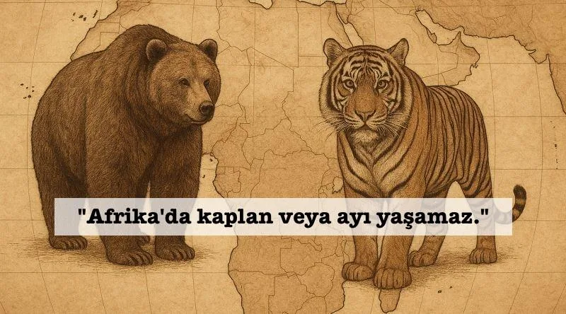
But the animal oddities don't stop there. Africa has no native bears and no tigers. Polar bears will never eat penguins, not because they're picky, but because they live at opposite ends of the Earth. Bears roam the Arctic while penguins stick to Antarctica. And Australia? The story often told is that it split from Pangaea before placental mammals evolved, leaving only marsupials behind. That's not quite right. Australia actually separated from Gondwana much later, after placental mammals already existed. The continent does have native bats and rodents. What it lacks is the diversity of placental mammals found elsewhere, which is why marsupials like kangaroos and koalas dominate the landscape, and why the platypus, a mammal that lays eggs, still survives there.
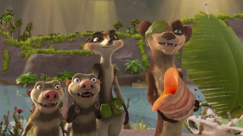
Madagascar and New Zealand, both isolated for millions of years, boast flora and fauna that are almost entirely endemic, meaning they exist nowhere else on the planet. Over 80 percent of their plant and animal species are unique to those lands. The opossums from the Ice Age movies? They're often called South America's only marsupials, but that's a myth. The continent hosts several marsupial species, including the monito del monte and various shrew-opossums. The opossum is just the most famous one.
Now, shift your gaze to political geography, where borders and territories get genuinely strange. Queen Elizabeth II, at her peak, served as head of state for 32 sovereign nations, more than a third of UN member states at the time. That included two Muslim-majority countries, Pakistan and Malaysia. The world map we all grew up with, the Mercator projection, was created by a Flemish cartographer, not as British propaganda. It does distort sizes, making Europe appear larger than it is, but Britain's northern position on the map is geographically accurate.
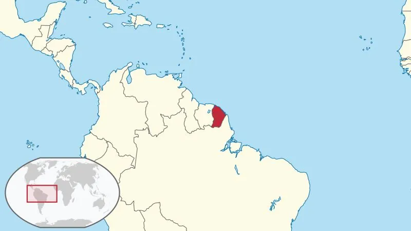
Turkey once held its only overseas territory in Syria: the Tomb of Suleyman Shah at Caber Castle. Under a 1921 treaty, that small plot was considered sovereign Turkish soil. French Guiana, sitting on South America's northeast coast, is an overseas department of France and part of the European Union. That means France's longest land border isn't with Germany or Spain. It's with Brazil.
France also wins the time zone contest. Counting its overseas territories, France spans 12 to 13 time zones, beating the United States with 11 and Russia with 9. The Pitcairn Islands, a British Overseas Territory in the Pacific, are often cited as the world's smallest country by population, with around 55 residents. They never joined New Zealand, despite what some stories claim. Films about the island's famous mutiny on the Bounty were nominated for Oscars, but none ever won.
Monaco, Europe's smallest coastal nation, covers about 2 square kilometers. That's smaller than Central Park in New York, which spans 3.4 square kilometers. The border arrangement between the UAE and Oman is a cartographer's nightmare. The Omani enclave of Madha sits inside UAE territory, and within Madha lies Nahwa, a UAE counter-enclave. It's borders within borders, a quirk that emerged from tribal land disputes that the British never fully resolved.
There are 44 landlocked countries on Earth, not 43. Only two of them, Uzbekistan and Liechtenstein, are double-landlocked, meaning every neighboring country is also landlocked. Canada holds about 60 percent of the world's lakes, with over 3 million scattered across its vast landscape. During winter, the Bering Strait's Diomede Islands, just 4 kilometers apart, freeze over, technically allowing someone to walk from Russia to the United States. It's illegal without authorization, but the ice makes it physically possible.
Lesotho is completely surrounded by South Africa, while San Marino and Vatican City are both encircled by Italy. Africa is so massive that you could fit all of Europe, China, Japan, the United States, and India within its borders. Portugal controlled several African colonies until the Carnation Revolution in 1974, but those territories never came close to a third of the continent. Ethiopia, however, was never formally colonized, aside from a brief Italian occupation from 1936 to 1941. That's why so many African flags feature green, yellow, and red, colors borrowed from Ethiopia's banner as a symbol of Pan-Africanism.
China isn't recognized by 15 UN member states plus the Vatican, which isn't a UN member. They recognize Taiwan instead. Somaliland and the Taliban's Islamic Emirate of Afghanistan are often called unrecognized states, but Afghanistan actually has diplomatic recognition from several countries. Israel isn't recognized by 26 UN member states, a record of sorts. North Korea and South Korea don't recognize each other, Turkey doesn't recognize Cyprus, and Pakistan doesn't recognize Armenia.
Brazil stands alone in South America as the only Portuguese-speaking nation, though the story about Portuguese explorers telling the Pope they thought they'd landed in Africa is unverified. Alexander the Great reportedly used maps by Anaximander, not Democritus, and the tale of Caesar weeping at Alexander's tomb comes from later sources, not contemporary accounts. Haiti wasn't founded by slaves from a single village, and North Sentinel Island's inhabitants have been isolated for perhaps 30,000 to 60,000 years, but calling them the least ethnically diverse region is unverifiable.
Nauru, a tiny Pacific island nation, does have alarmingly high obesity rates, but its UN voting pattern isn't purely emotional. Paraguay's gender ratio isn't the world's highest, despite the devastating Paraguayan War in the 1860s. Monaco has the highest share of elderly residents at 26 percent, Italy has a significant elderly population at 18 percent, and Niger has one of the youngest populations, with 48 percent under 15.
Texas cannot legally secede from the United States, a fact settled by the Supreme Court in Texas v. White. The Louisiana Purchase in 1803 doubled the young nation's size for about $15 million, covering roughly a third of the current contiguous US. Russia sold Alaska in 1867 because it was hard to defend and unprofitable, not because anyone thought it was small. And the US, home to about 45 million immigrants, has a birth rate around 1.6 children per woman, hardly zero.
Editorial note: Any facts which remain unconfirmed are presented as such, clearly hedged within the narrative.
Got a take on this? Add your voice to the conversation below →
No comments yet. Be the first.